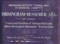
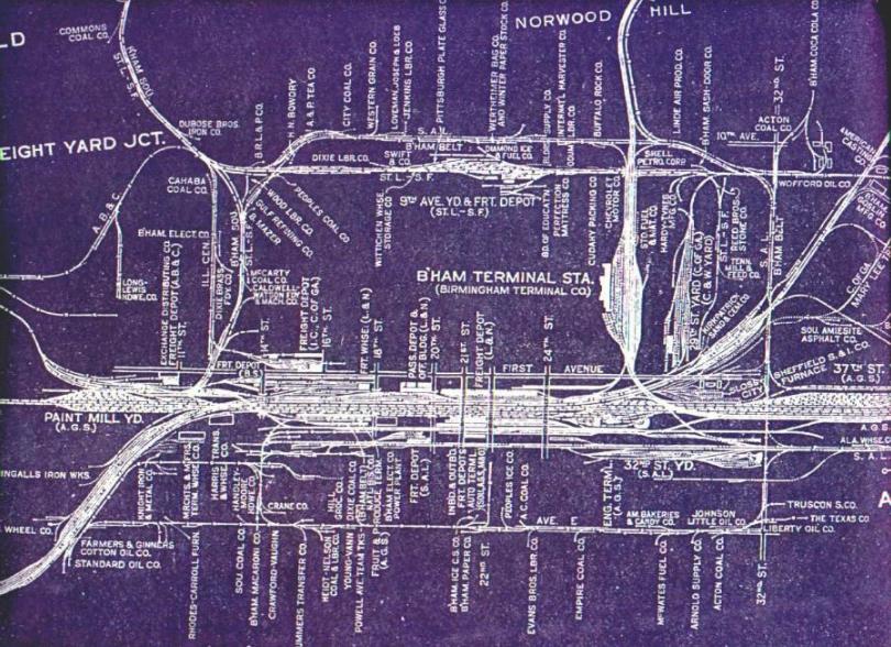
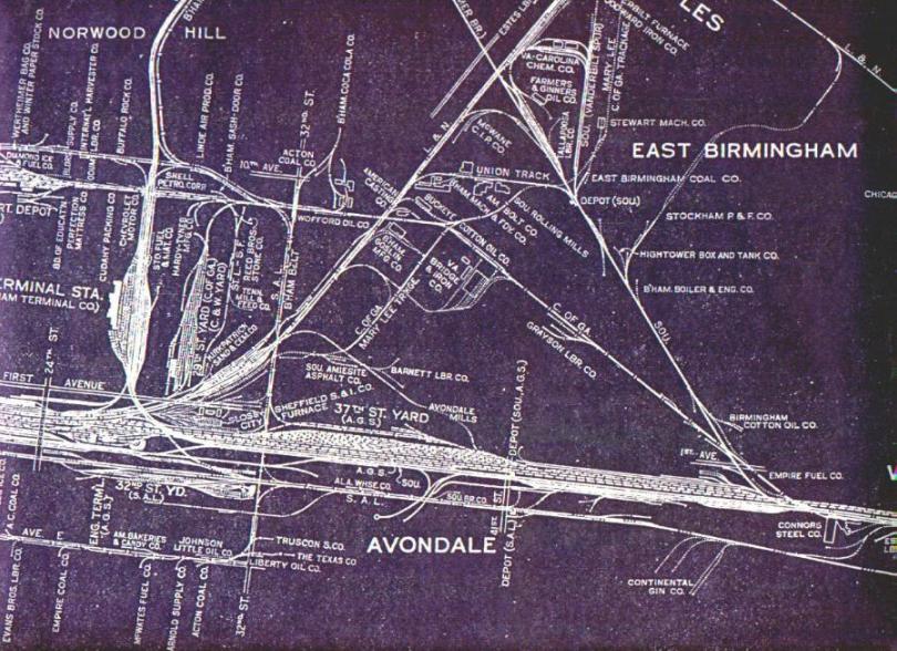
1935 Rail Map
This map was really was exciting when I found it. It is also an example of a source of information which I am able to share, but have no way of giving proper credit to the source. The story is typical of why I like the interest and hobby of railroads.
 I
attended a model railroad show, like a flea market, several years ago, here in
Birmingham. A fellow had a table set up to sell something or other, and
when I stopped to talk to him, I noticed that he had a large roll map, that
appeared to be an old paper blueprint. I asked if i could see it, he
shared it with me, and I was fascinated. He said that he had found it in a
flea market in Atlanta and purchased it. I asked if it was for sale, and
he seemed surprised that anyone would want to buy it. He went on to say
that he had thought about making copies, but wasn't sure how to go about it,
since it is large, about 3' x 7'.
I
attended a model railroad show, like a flea market, several years ago, here in
Birmingham. A fellow had a table set up to sell something or other, and
when I stopped to talk to him, I noticed that he had a large roll map, that
appeared to be an old paper blueprint. I asked if i could see it, he
shared it with me, and I was fascinated. He said that he had found it in a
flea market in Atlanta and purchased it. I asked if it was for sale, and
he seemed surprised that anyone would want to buy it. He went on to say
that he had thought about making copies, but wasn't sure how to go about it,
since it is large, about 3' x 7'.
Being a Civil Engineer, I suggested that he could go to a blueprinter and have copies made for a reasonable amount then sell them. He said that he would. Next time there was a train show, he was there selling the maps for $15, and I was proud to have one. I suppose that there must a number of copies around town by now, but I've not run across one on the Web. I hope you enjoy it as much as I have.
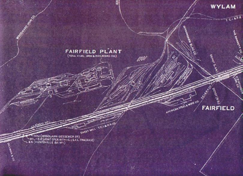
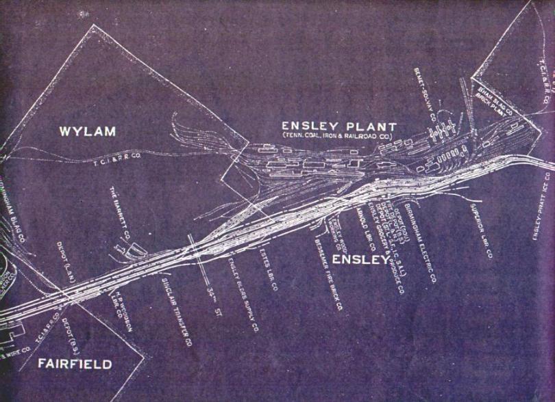
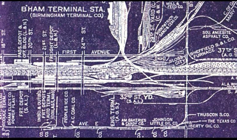
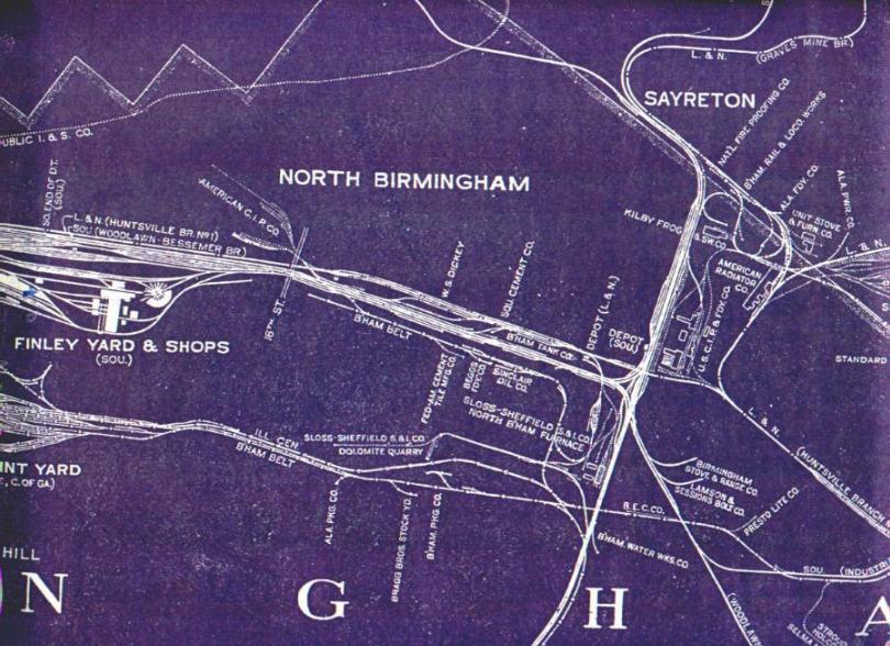
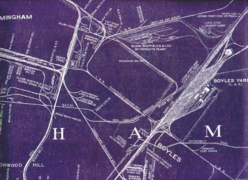
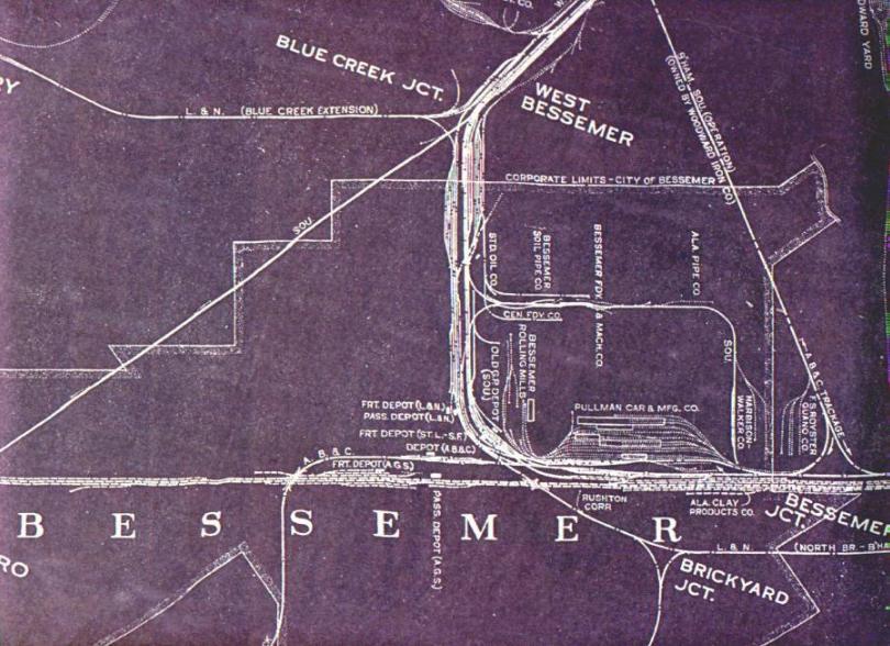
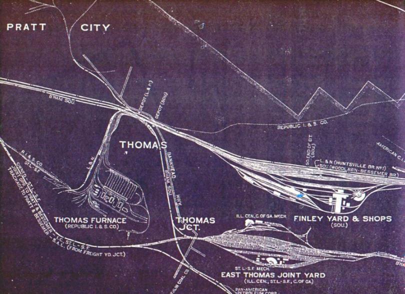
I have scanned the entire map in 8 1/2" x 11" segments. There are 36 in all. In the first set below, you will find selected sections that may be of general interest. The files are JPEG's, and are about 150k each, at a resolution of 72 dpi. They provide a lot of interesting information about the active railroads, before mergers, they show locations of now abandoned tracks, and they provide the names of many business that we no longer see in town.
If you are interested in model railroading, this map provides a great source, coupled with other maps, field trips and photos, to develop plans for a model railroad that has Birmingham industry as a theme. That is what I am working on, but it is slow going because I get distracted on projects like this one.
The following links preview the larger map by
highlighting areas of interest. These areas of interest are presented with
the area centered in the image. In the larger grid set offered below,
which covers the entire map, the grid determines the placement of the images,
and they are not conveniently centered. All of these images are between
100k and 150k files.
| Bessemer |
The entire map is also available as a series of patchwork images, on separate web pages, oriented per the grid below. The individual sections are linked to the adjacent sections, so that you follow the map from one image to the next. If you are not familiar with Birmingham, you may want to start out with section 2G, below, which is most of the downtown area, and then navigate around from there.
Map Grid--Grid has origin at the southwest corner of
the map. Long axis of map is about N 45 E. Files are same size as
above.