Birmingham Belt Railway
 |
| Click here to go to an 1880's map of the Belt |
|
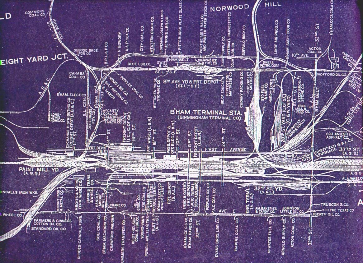
This segment of the "big blue map" of the Birmingham Bessemer Terminal District shows how the Birmingham Belt surrounded the downtown area. It also shows the extent of all the other tracks located in downtown Birmingham.
By the time this map was made in 1935, the Grade Separtation project along the Railroad Reservation had been completed.
Notice that the Belt ran on Avenue E (5th Ave. S) and then north on 32nd Street, then along 10th Avenue N. It is believed that by 1935 the Belt had operating agreements wiht the Frisco (St. Louis-San Franciso) to complete the loop of downtown.
There were other tracks operated by the Belt, and you may hunt for those on the 1935 map elsewhere on the website. You will generally find them to the east of this view.
In this map note the Frisco line that ran in 9th Avenue N left to right, a block south of the Belt Line tracks in 10th Avenue. The interstate, I-20/59 was located on this corridor. There are still crash walls visible under the interchange of I-20/59 and US 31/280.
I-65 was located east of the Illinois Central tracks located in 12th Street North.
Let the mouse hover over the blue map to see today's Google Earth image. |