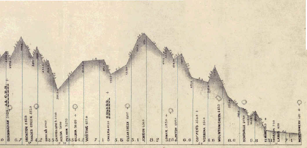
Brock's Gap
1874 Profile Drawing
 |
|
| A & C RR = Alabama & Chattanooga RR S R & D RR = Selma Rome and Dalton RR | |
|
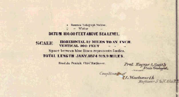
This is a profile of the line from Montgomery to Birmingham -- The South and North RR, dated 1874. This image comes from the map archive at the University of Alabama.
A profile view is used in Civil Engineering to show a long alignment in a short space. Thus, the vertical is greatly exaggerated. In this drawing, the vertical is exaggerated over 300 times! So, the railroad grades are not nearly as steep as they look.
Railroads require flat grades (rise per run) -- 1% is a pretty steep grade for a railroad. That means that if the line rises 50 feet in one mile, the grade is about 1%.
The numbers on the slope are the grade in feet per mile, a common measure in railroad engineering. Thus, the grade from Cahaba Mines Switch to Brock's Gap was 54.6 feet per mile, or better than 1%. |
 |
This drove the engineer to call for "more curves" since curves added length to reduce grade. Unfortunately curves also
add resistance. All of this added up to operation cost due to relative short trains. This is why, when budgets allowed,
the L&N came back to Brock's Gap and drove a 900 foot tunnel under Shades Mountain.
Previous Page Next Page (Large file, 2 meg, aerial image)