Lehigh Mines
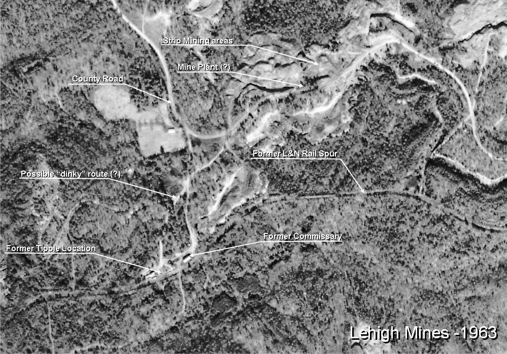
This image from the UA Map Archive shows the Lehigh Mines area in 1963. By comparing this to old maps, the items have been labeled as shown. Remember that the 1922 map of the mine property referred to the mine as being "1 Mile" away. So far, Birmingham Rails has not been able to find a mine location that is one mile away for the former tipple site. There does seem to be a possible site along a creek north of the property, but no confirmation has been found for any of the drift mine locations.
The
The
The
The 1961 USGS 7 ½ Minute Quad maps show the spur in place, and show strip mines surrounding the end of track. The place name “Lehigh” is not shown.
The 1970 USGS 7 ½ minute map shows the spur as “abandoned”.
So, other than the strip mining permits noted on the EPA internet database, there is no additional information at this time about Lehigh Mines. It may be that it has gone quietly into obscurity, and that Mother Nature is slowly reclaiming the former mine sites.