Mary
Lee Mine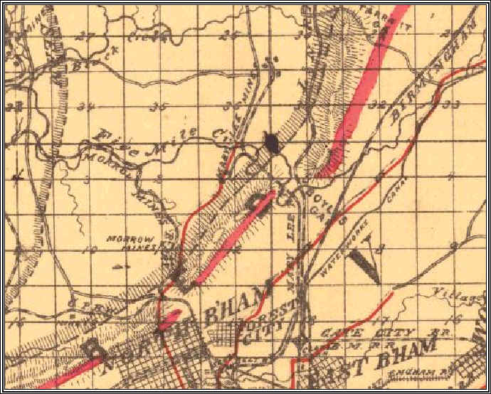
1892 Map
This is a detail from an 1892 Jefferson County map from the UA Map Archive. The Mary Lee is clearly shown on this map, with branches along the Stout's Road, forerunner of US 31.
The most notable landmark in this map is Boyle's Gap where both the L&N RR and the Mary Lee RR cross through the ridge.
Notice that Lewisburg is not named on this map.