Mary
Lee Mine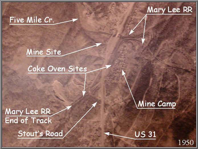
1950 Aerial Photo
This is a 1950 aerial photo showing the site of the Lewisburg No. 1 Mine, believed to be a successor to the Mary Lee Mine.
This shows the estimated location of the mine, a mine "camp" village, and possible battery coke ovens along the Stout's Road and US 31. It is estimated that these were closed by 1950.
The key feature here is the curve of the RR line as this can be followed clearly in the other maps.
Place mouse over photo see see conditions more recently with the interstate in place.
Lewisburg No. 2 Mine Photo (just to north)