Eureka Company
This is a February, 1941 aerial photo used by the SCS in mapping. Birmingham Rails has highlighted the tramway routes with a white dashed line, offset from the trampath so that it may be seen clearly. The crest of Red Mountain is visible in the upper left area of the image. This photo, used with the maps from the 1880's led to the field discovery of the tramway path in 2006.
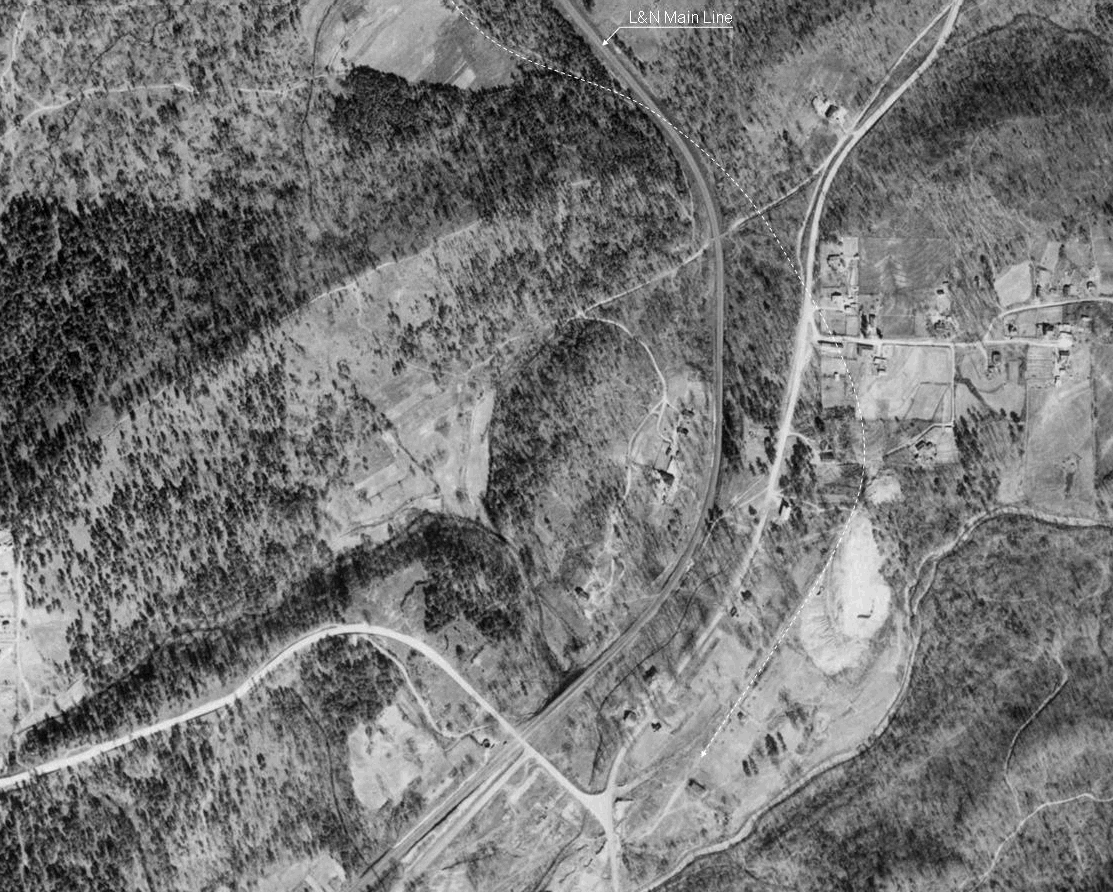
The area above at the bottom of the photo is the Oxmoor site in 1941, 13 years after the furnaces were dismantled in 1928. The estimated location of the tramway path is shown after it crosses the railroad based on conjecture by Birmingham Rails.
On the next page are a set of images from the Fall 2006 field trips to the Eureka Mine and tramway site. You will see a photo image surrounded by thumbnail size photos. To view any photo, click on the thumbnail and the large central photo will change.