Historical Maps
There is a great map site at the University of Alabama Historical Map Archive. This site includes rail maps pertinent to Alabama and local maps of Birmingham as part of the County map portion.
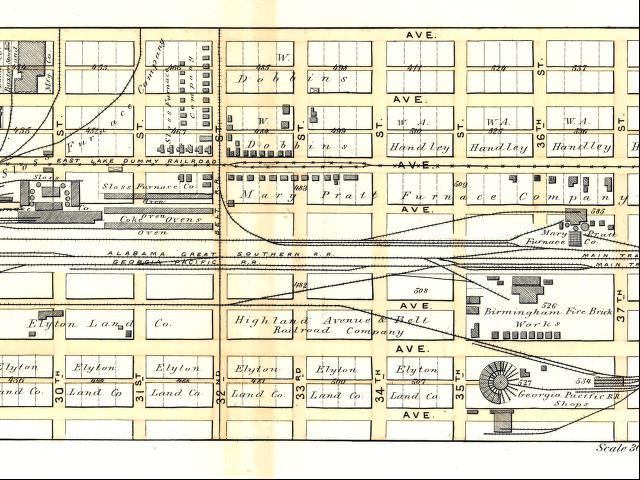
One that is of particular interest is the 1887 map, Atlas of the City of Birmingham and Suburbs. This map can be compared to the 1885 oblique aerial drawing includes on this website and available from the Historical Map Archive as well as the Library of Congress website. This 1887 Atlas shows the rail lines, streetcar lines, individual block ownership in very good detail.
Here is a sample saved from the site. Enjoy.
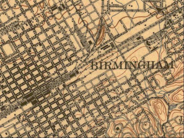
This site also has a collection of historical quadrangle maps. They include 30 minute, 15 minute and 7.5 minute. Here is a sample from the 1906 vintage, 15 minute maps:
Have fun: University of Alabama Historical Map Archive. And don't forget to come back.
Another source of historical maps: David Rumsey Map Collection Cartography Associates. This is an interesting website -- I have had success with the "insight" browser, and looking at "States" and "Alabama". There is a very nice 1893 map of Alabama, and zooming in you may see local place names along the railroads.