Mary
Lee Mine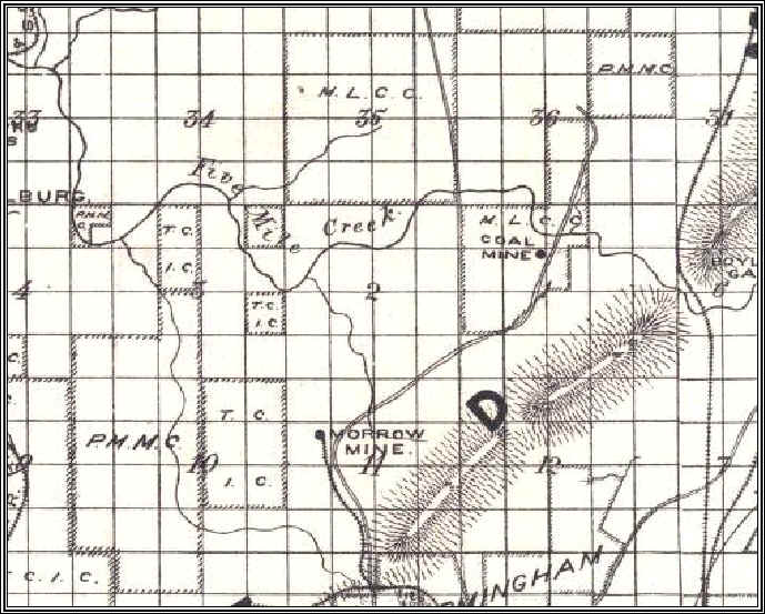
1889 Map
This is a detail from an 1889 Jefferson County map from the UA Map Archive. The most notable landmark is Boyle's Gap where the L&N RR crosses through the ridge. There is no Mary Lee RR noted on this map.
The tract is noted MLCC, which is believed to be the Mary Lee Coal Company.
Morrow Mine is a related development, involving John Milner or his associates.
1892 Map