Mary
Lee Mine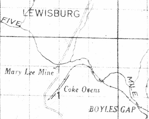
1916 Map
This is a detail from an 1916 TCI map titled "Birmingham District".
On this map, mine slopes are shown with a symbol, which although hard to read, is shown just above the "e" in "Mine".
This indicates that the mine opening was just west of Stout's Road, and just south of Five Mile Creek. This map also clearly indicates coke ovens.
The key feature here is the curve of the RR line and the creek as these can be followed clearly in newer maps.