TCI High Ore Line
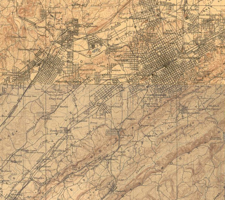
This map is dated 1906, shows the Birmingham area including areas where TCI was operating or would develop. Note that this year of 1906-1907 turned out to be a financial "panic" year, and was the year when U.S. Steel convinced the Roosevelt administration, notorious as "trust busters" that the acquisition of TCI by USS was good for the country -- since it would prevent the fall of the financial house of Morgan.
L&N as well as other railroads had a major presence in the area, and L&N was already operating the Mineral railroad along Red Mountain. But it must have been a major feat to get ore trains from the mountain, on the right of the map, to the Ensley furnaces on the left of the map.
Soon after USS acquisition of TCI, there would be major developments at Fairfield, which does not show on this map, but would be located due south of Wylam (left edge of map) and east of the railroad. From this proposed location, it must have been frustrating to the Company to know that the mines were about 5 miles away as the crow flies, but much more than that as the trains ran.
 |
1906 Birmingham Area Map |