TCI High Ore Line
This map is "zoomed in" from the previous one and shows the area where the High Ore Line would be built. The map shows that although there was mining activity on Red Mountain, and there was a growing rail network, including the streetcar lines linking Birmingham to Bessemer, but there is no Fairfield and certainly no high line.
In the upper left corner of the map is the future site of Fairfield, and in the lower center, the mining community of Winetka. These are the points that the High Ore Line will connect. In the lower portion of the map, note that the "Birmingham Mineral" line is already operating on Red Mountain, but consider that TCI operates at Ensley, located just off the top of the map -- so the problem that they faced was how to get the iron ore to the blast furnaces in a growing and already busy rail network. It must have been a dispatcher's nightmare.
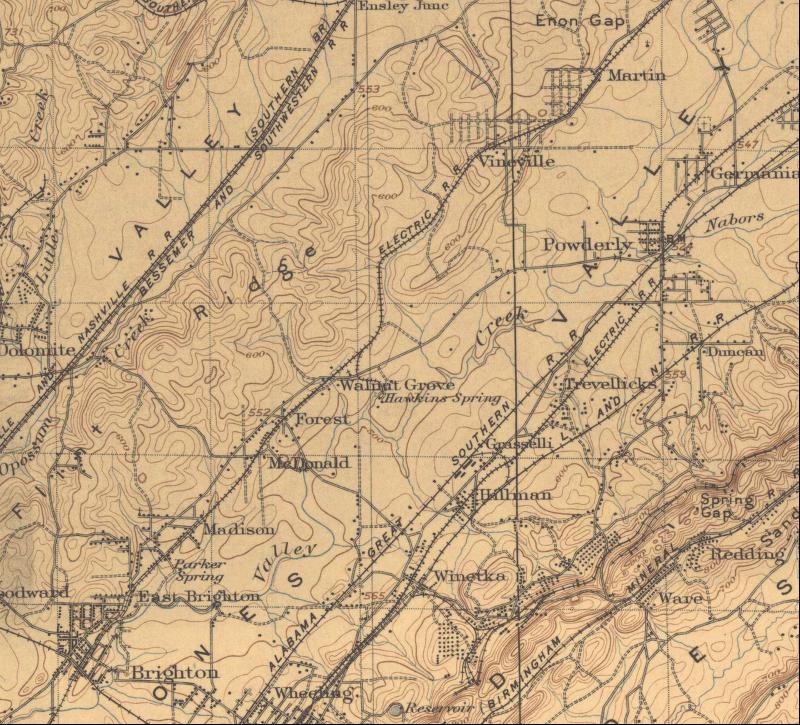 |
1906 Birmingham Area Map -- Site of future High Ore Line(Mouse over map to see route of high ore line) |