TCI High Ore Line
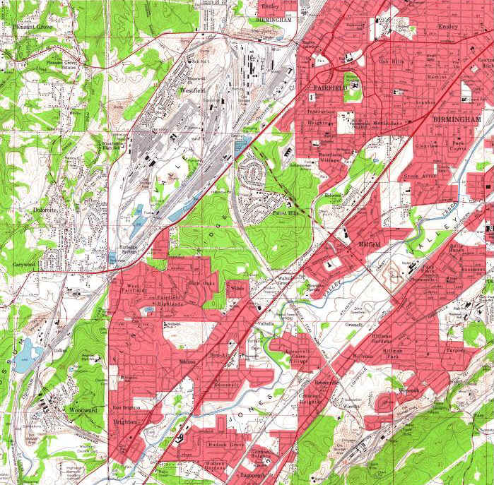
This map is a 1959 USGS quad map of the area where the High Ore Line is located. In the upper left you can see the Fairfield Works, where the words "VALLEY" and "Westfield" are located. You can see that the line literally went cross country, directly from the mill to the mines. The following pages are a more detailed view along the High Ore Line from Fairfield Works to Winetka.
 |
TCI High Ore Line -- 1959 Area Map |